Browse through our apps listed below by clicking through the dots. All of our Apps listed below support 2013 – latest version of Autodesk products with the exception of a few due to API changes or improvements. Verify supported versions on each app as listed or on the Autodesk App Store page. Support for new releases are typically issued at the time of the new release rollout or within a month’s time of the new release.

Supports AutoCAD Civil 3D 2013 – Latest Version
This set of productivity tools contains an array of time saving tools for repetitive tasks with Pipe Networks all contained on it’s own ribbon tab.
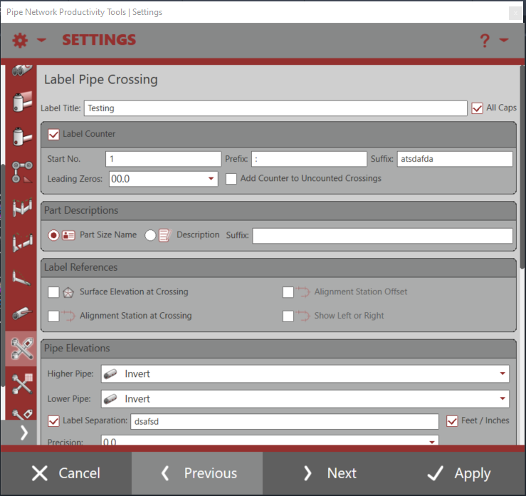
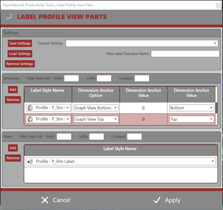
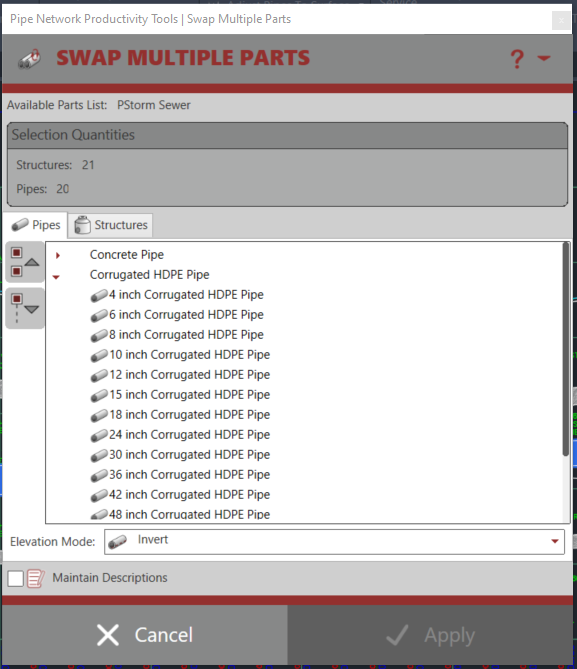
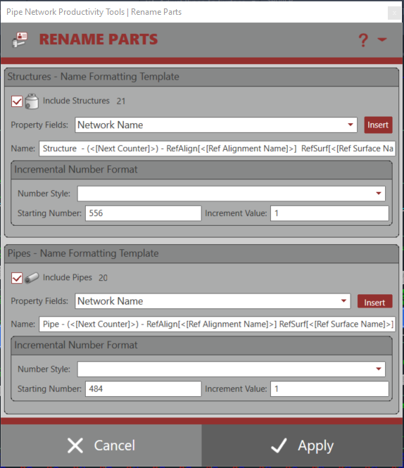
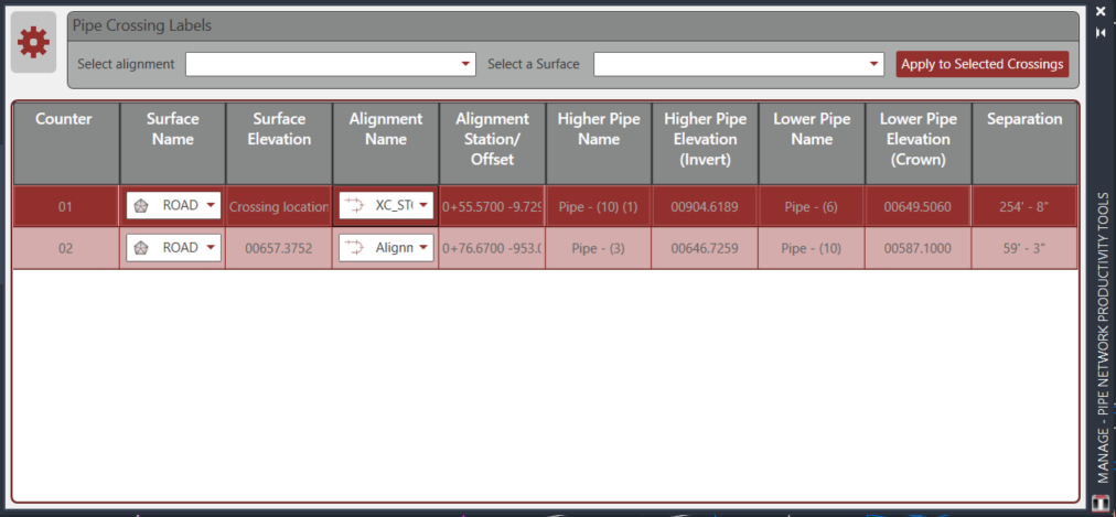
They provide increased productivity to the following Pipe Network tasks: Swapping Parts, Adjusting Pipe Elevations, Adding Wye Connections, Modifying Part References, Modifying Part Descriptions, Modifying Part Styles/Rules/Materials, Labeling Pipe Crossings, Labeling Pipe Elevations at any Point Along Pipe, Renaming Parts, Gathering Quantities, Daylighting Pipe at Surface, and Modifying Hydraulic Properties.
Where applicable, all of the tools allow for handling multiple objects with three selection methods: Network, Multiple, and Path. Network collects all parts inside a selected Pipe Network, Multiple allows the user to select multiple parts on screen, and path allows the user to select a start pipe/structure and an end pipe/structure and return all parts in between along the shortest path through the network.
Many of these easy to use tools also provide selection capabilities from plan and profile views. Any experienced user of Pipe Networks will immediately recognize the benefits these tools provide.

Supports AutoCAD Civil 3D 2013 – Latest Version
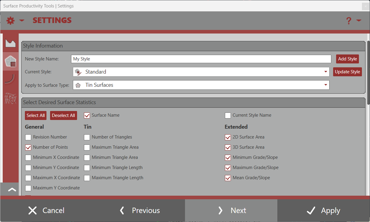
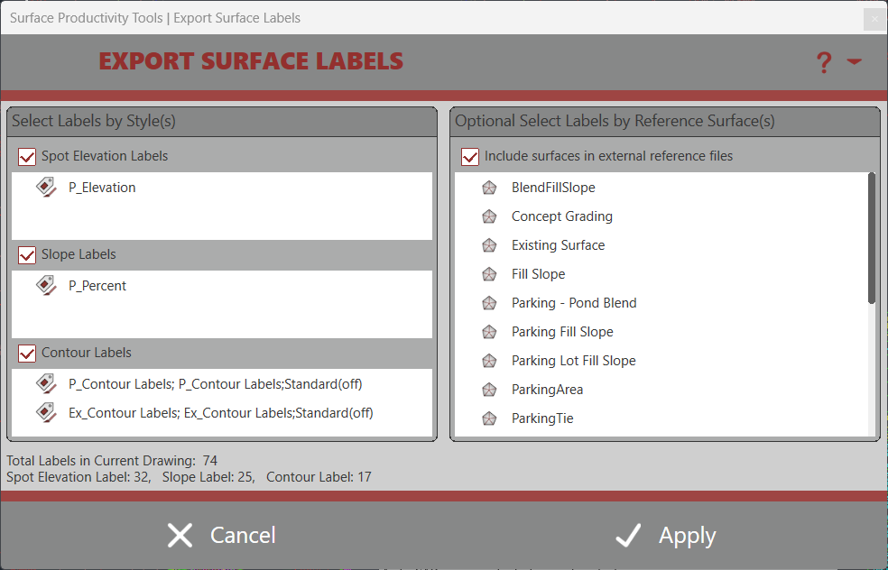
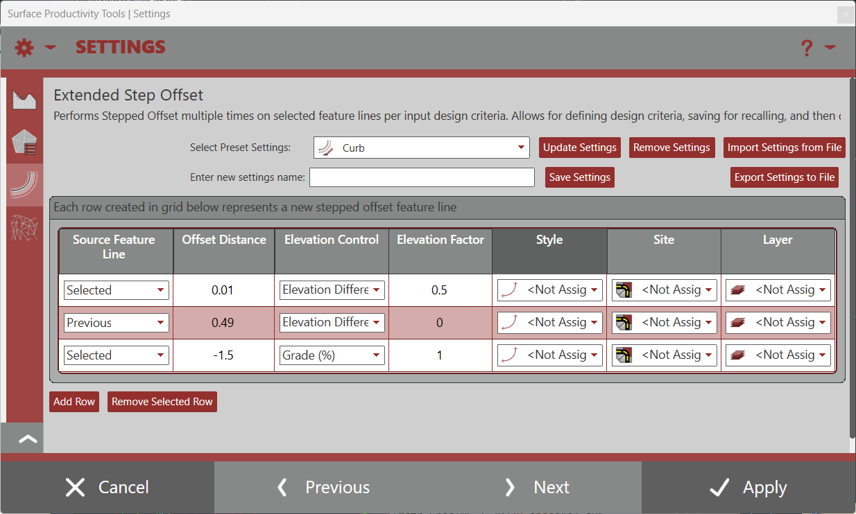
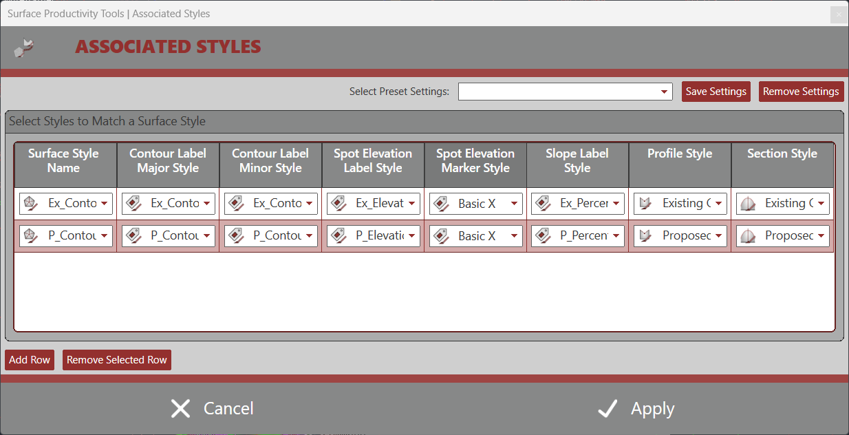
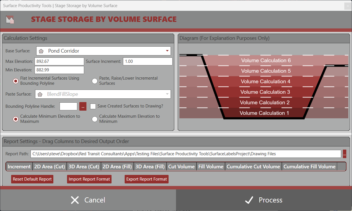
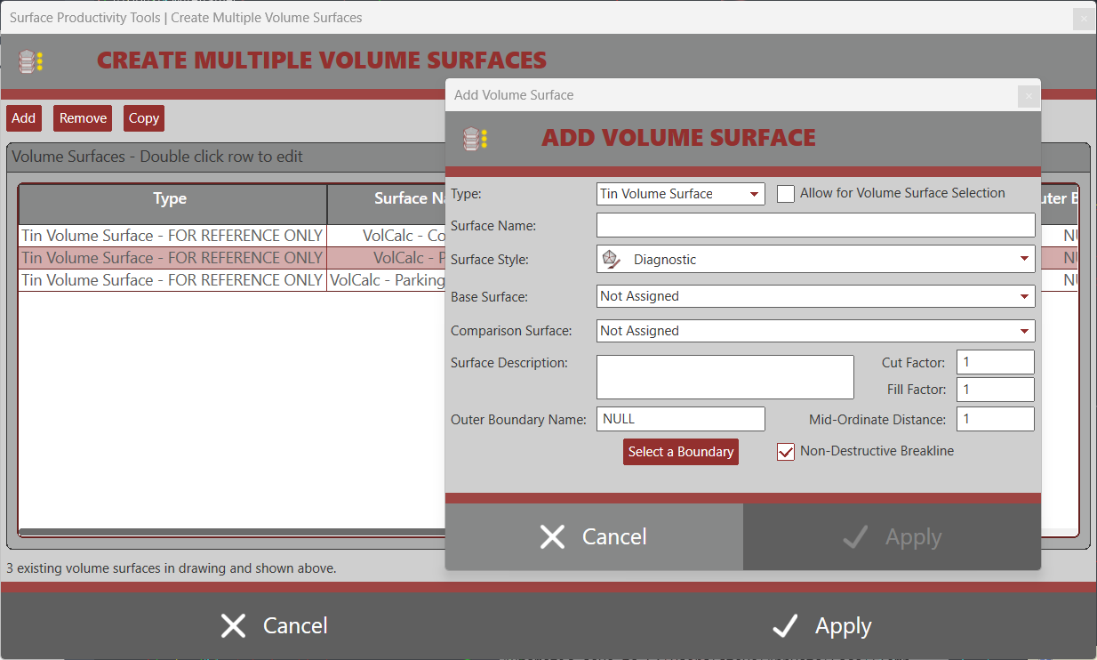
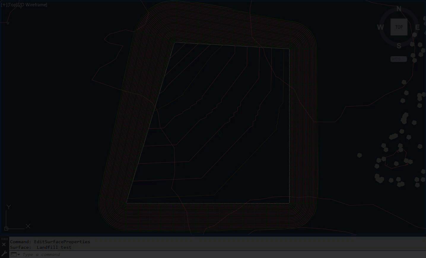
This app is a set of tools that have been created over time allowing for time savings in various tasks dealing with Autodesk® Civil 3D® Surfaces and Profiles.
Popular tools sold separately such as Grade Slope Along Surface and Import Export Surface Analysis are included in this suite. Additionally, new tools for Surface/Profile productivity are provided such as, Extended Step Offset for Feature Lines, Surface Statistics Labeler, Extract Surface Border, Extract Surface Contours, Surface Associated Styles, Match Profile Views, Replicate Profile Views, Copy, Raise/Lower Profile, Trace Profile with Polyline, and ability to Create Multiple Volume Surfaces at once.

Supports AutoCAD Civil 3D 2019.2 – Latest Version
The Lot Grading Tool provides tools and settings to assist in the design and grading of a residential subdivision. The Lot Grader command expects that lot lines are Feature Lines with assigned elevations at the right of way established from a road design surface and that pads are four sided lines, joined as a closed feature line. From here, the lot grader allows for a fence selection across lot lines and pads and will utilize the settings to establish elevations and grades of the lot lines, pads, and the creation of reveal feature line linework offsetting from the pad feature line.
An additional command called the Lot Labeler, allows for labeling multiple feature lines PI points and line slope/grades with desired styles, either in the same drawing or in another drawing containing the same surface. The Lot Labeler allows for taking your grading performed with the Lot Grader to a plan sheet for quickly reviewing the establish elevations, slopes/grades across the site.
The Lot Grading Tool is not meant to replace the engineering that goes into a lot grading plan, but merely expedite a repetitive process to allow one to spend more time reviewing a grading plan instead of executing a grading plan. The tool can quickly take you to an 80% completion level. However, you are, as always, responsible for reviewing the pads and spot grades and adjusting where necessary to ensure you are meeting firm, client, and municipality grading and drainage standards.
If you’d like to request a trial, please email [email protected]
Supports AutoCAD Civil 3D 2013 – Latest Version
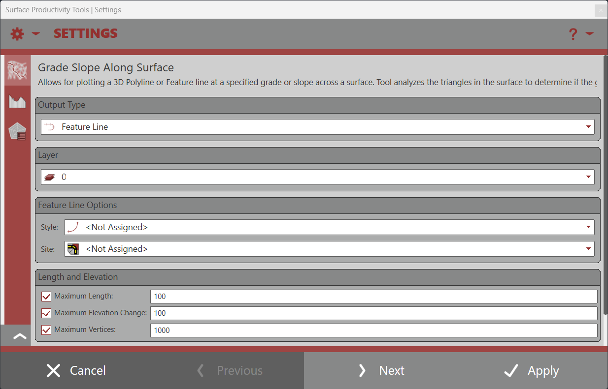
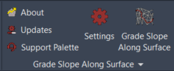
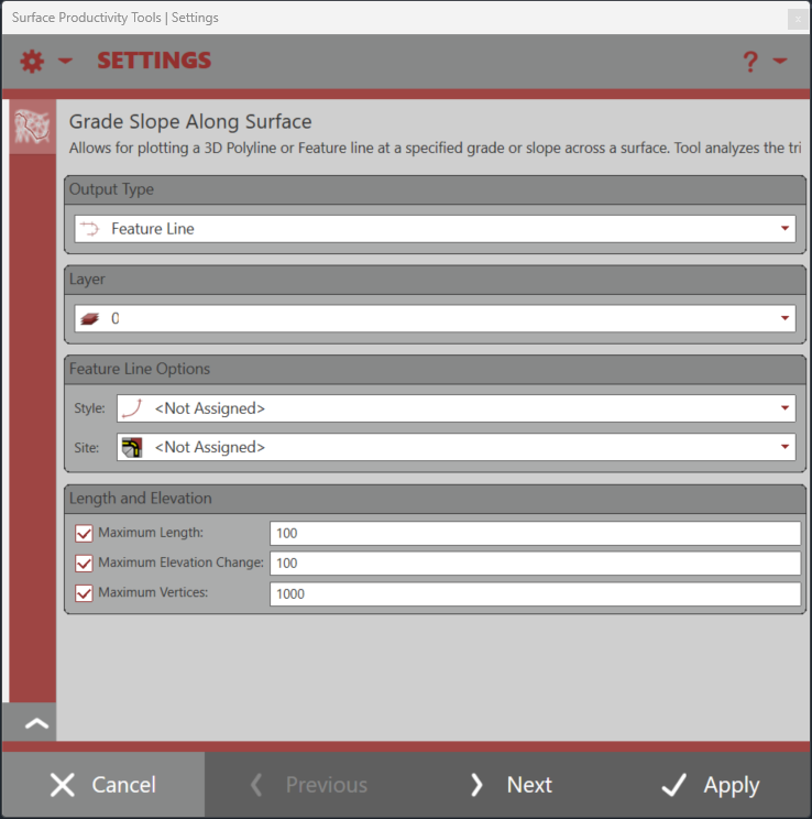
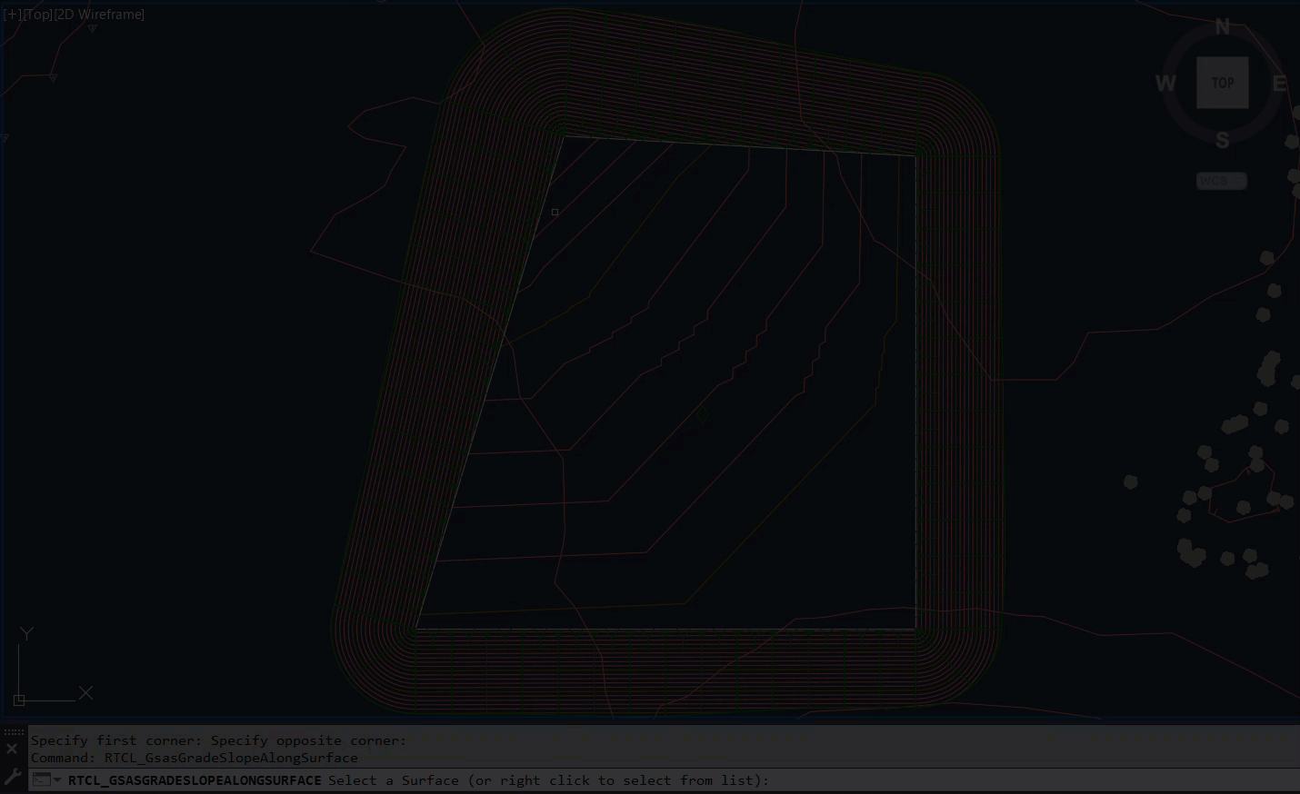
Sold a-la-carte but also included in our Surface Productivity Tools with extended capabilities, this app uses a unique algorithm that extracts data from the selected tin surface and performs trigonometry calculations to draw a 3D polyline along the tin surface at the desired grade/slope.
3D Polyline vertices are computed at the triangle edges resulting in vertices that match the surface data. Converting the 3D polyline to a feature line results in grades that accurately represent the input grade/slope.

Supports AutoCAD Civil 3D 2013 – Latest Version
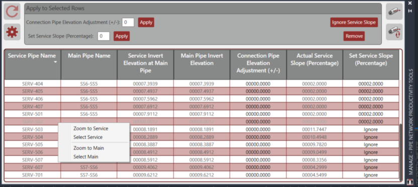
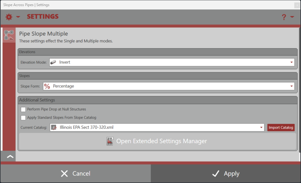
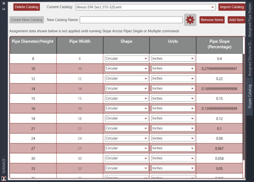
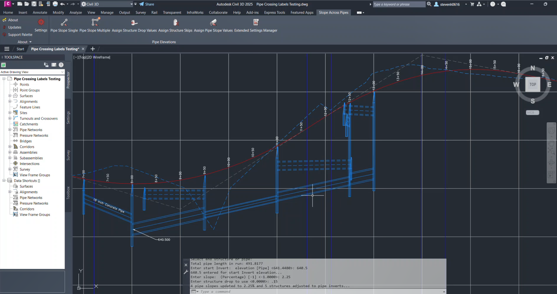
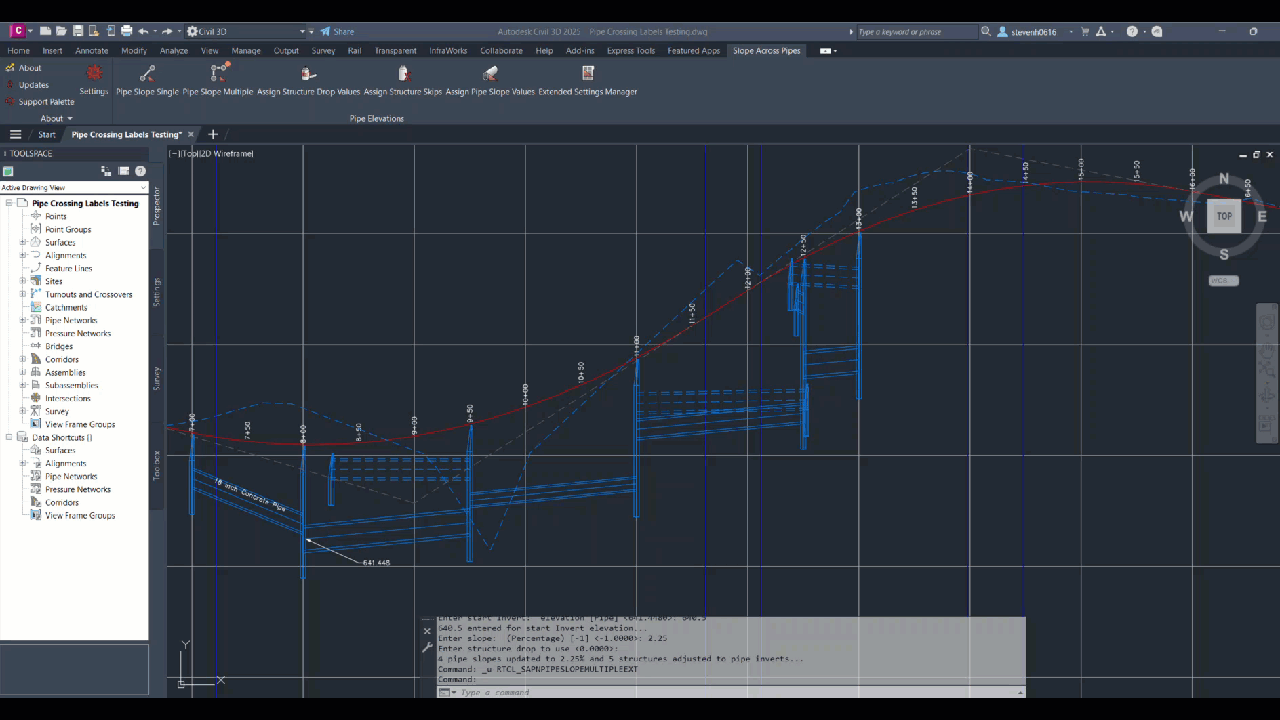
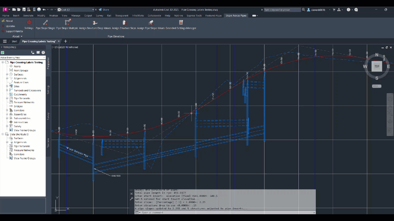
Sold a-la-carte but also included in our Pipe Network Productivity Tools with extended capabilities, this app provides tools for quickly modifying pipe elevations and slopes. The app supports modification of elevations by centerline, crown, or invert while offering a command for single pipes and a command for multiple pipes.
The app supports both circular and non-circular pipes types. The Pipe Slope Single command allows for quickly setting the elevations and slope of a single pipe. The command allows for selecting pipes/structures in plan view or pipes/structures in profile view and offers two modes, by slope and by elevations. With mode by slope, select the pipe in plan or profile view by the desired end of the pipe to modify the invert and apply a slope holding the selected end and invert of the pipe. With mode by elevations, select a pipe in plan or profile view by a desired end and the app will prompt for elevations for either end of the pipe and set the slope based on those elevations. The command also provides the ability to select another pipe and inherit it’s elevation to be used in the modified pipe.
The Pipe Slope Multiple command allows for quickly setting the slope of a number of pipes within a common pipe network and applying pipe drop across each structure. The command allows for selecting pipes/structures in plan view or pipes/structures in profile view and offers two modes, by slope and by elevations. When selecting parts in profile view, the command also provides the ability to extract the selected point elevation from the profile to apply to the pipe network. For both modes, the command does not care if the upstream or downstream end is selected, nor does it care if the start and end points of the pipes are in the same configuration throughout.

Supports AutoCAD Civil 3D 2013 – Latest Version
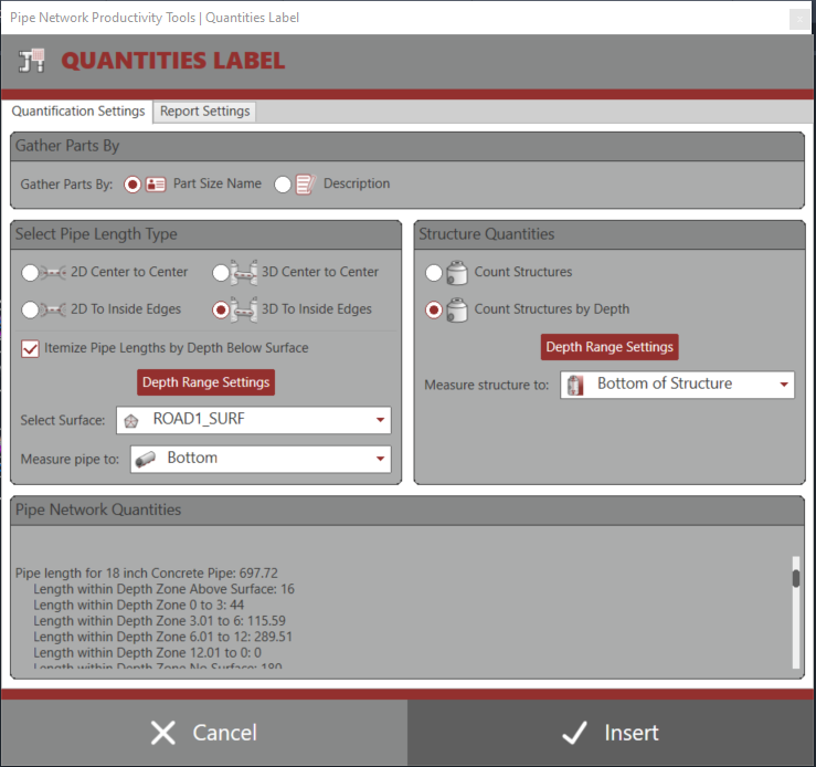
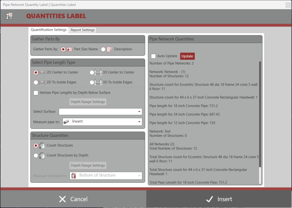
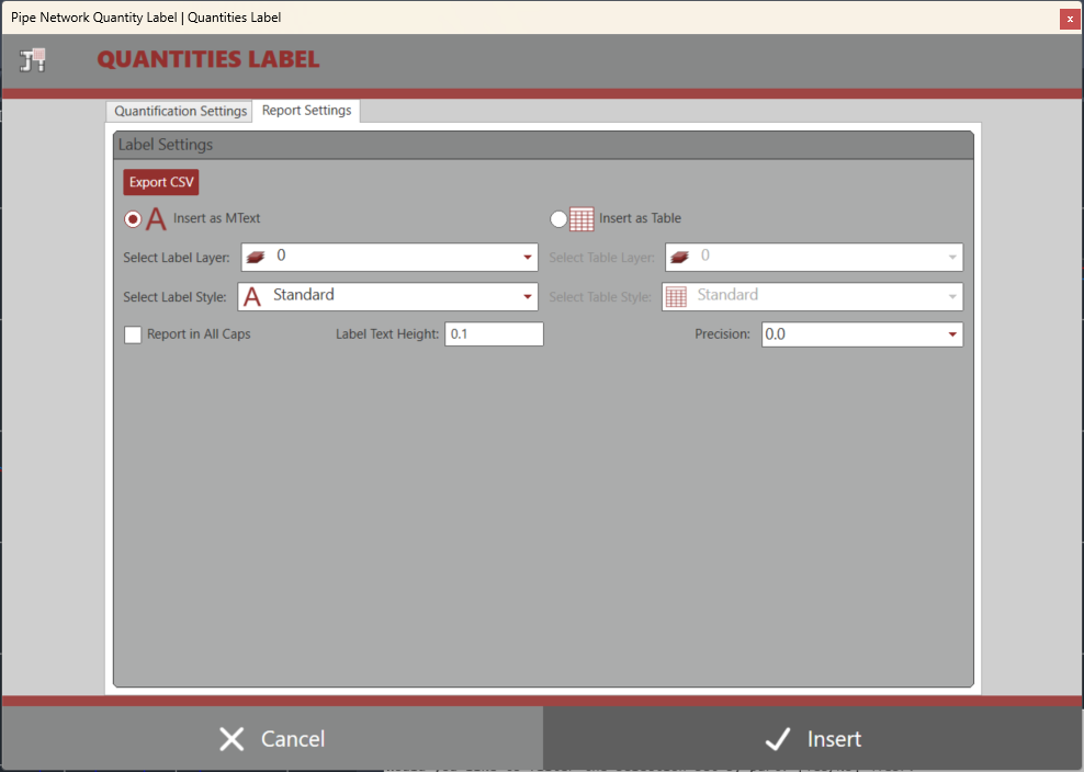
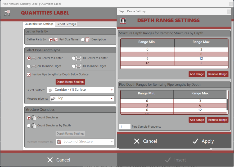
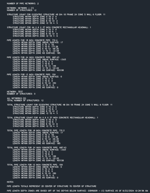
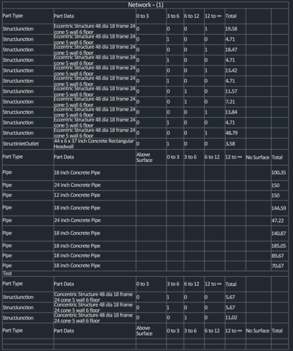
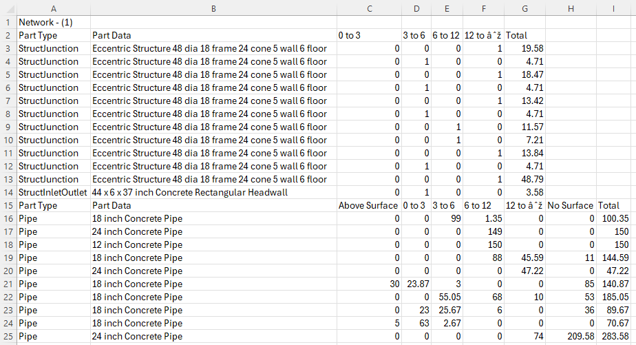
Sold a-la-carte but also included in our Pipe Network Productivity Tools, this app offers the ability to quickly select network parts through multiple selection options with ability to filter out parts, then to be able to quickly summarize a quantity list of those parts as Mtext, Table or CSV file. Quantities are gathered by PartSizeName or Part description, Pipe Lengths of 2D/3D Center to Center / edge to edge, Structure quanties, and abilty to quantify depths below a specified surface.
Pipe depths are summarized by sampling the pipe elevation at specified location of pipe vs the surface at a controllable sample frequency. Structure depths off multiple depth choices. Reports are summarized by parts of like PartSizeNames or Part Descriptions to help gain a summary of the design. Selection of parts is done with 5 methods: selection methods: All, Network, Multiple, Alignment and Path.
All collects all Networks and parts in those networks. Network collects all parts inside a selected Pipe Network, Multiple allows the user to select multiple parts on screen, Alignment allows for selecting multiple Alignments and Networks and finds parts within a defined swath along the selected Alignments, and path allows the user to select a start pipe/structure and an end pipe/structure and return all parts in between along the shortest path through the network.
Supports AutoCAD Civil 3D 2013 – Latest Version
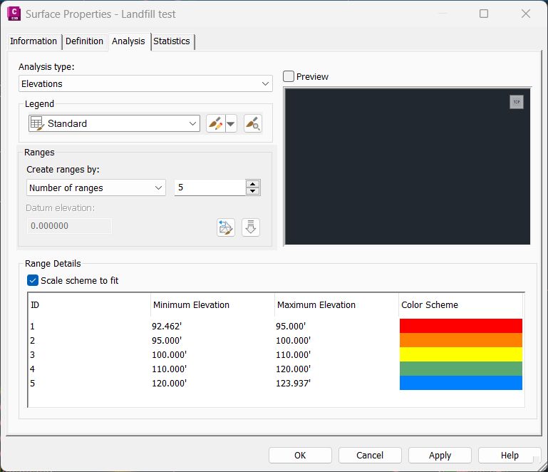
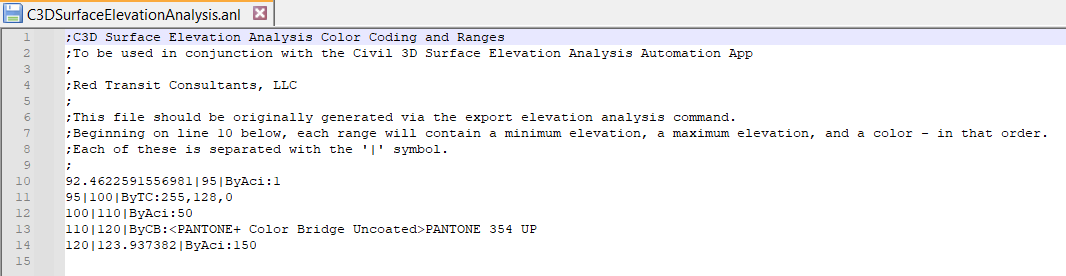
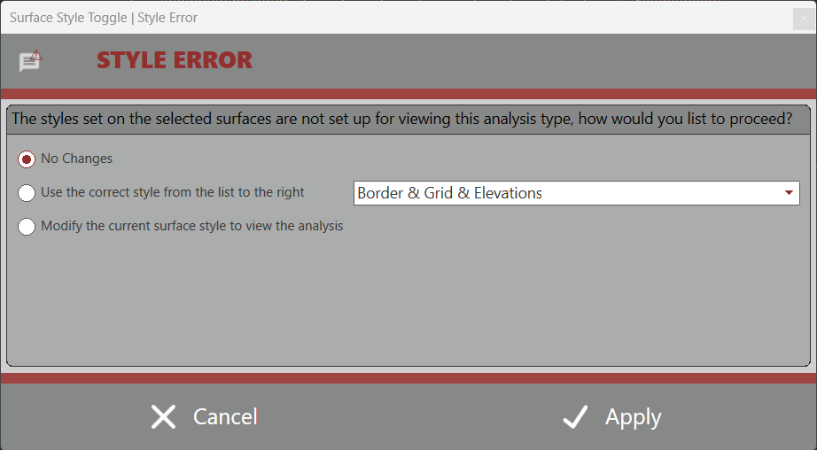
Sold a-la-carte but also included in our Surface Productivity Tools, this app exports any surface analysis and corresponding properties to text by selecting the export analysis type and a surface with that type of analysis applied to it. Then, as needed it will import a selected text file (previously exported) and apply it to a new surface with the exported analysis information. It also has built in option to verify the style has been created correctly for viewing the analysis – alleviating the user from wondering why an analysis may not be appearing.
The app handles 6 different surface analysis types; Contour, Directional, Elevation, Slope, Slope Arrows, and User Contours. Installing the app provides separate Import and Export commands for each analysis type, housed under one drop down ribbon button found on the Add-Ins tab.
Supports AutoCAD Civil 3D 2013 – Latest Version
This app automates the process of exporting profile view data and profile data to DXF format for use with 3rd Party landslide calculation Software. Manually processing requires users to explode a profile view so that the profiles are in polyline form, trace the profile view’s right and left boundaries and the datum line for each profile view, close each profile off as individual closed polylines, and then move each polyline by a station/elevation value to a corresponding X,Y value. Then the user has to WBLOCK each polyline out to it’s own file, and finally go through each file to create a DXF.
This app automates the entire process and names the files corresponding to the profile name. It also creates an overall merged boundary polyline of all profiles, used for setting up SLIDE’s spatial area for import.
NOTE: This app is also great for those looking to export a profile view for someone to use in basic Autodesk® AutoCAD®. Each polyline is placed on it’s own layer corresponding to the profile name on export.
Global locations we’ve served
Locations shown on map are approximate to protect customer privacy.